
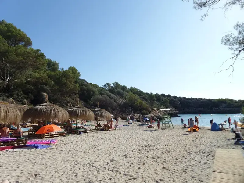
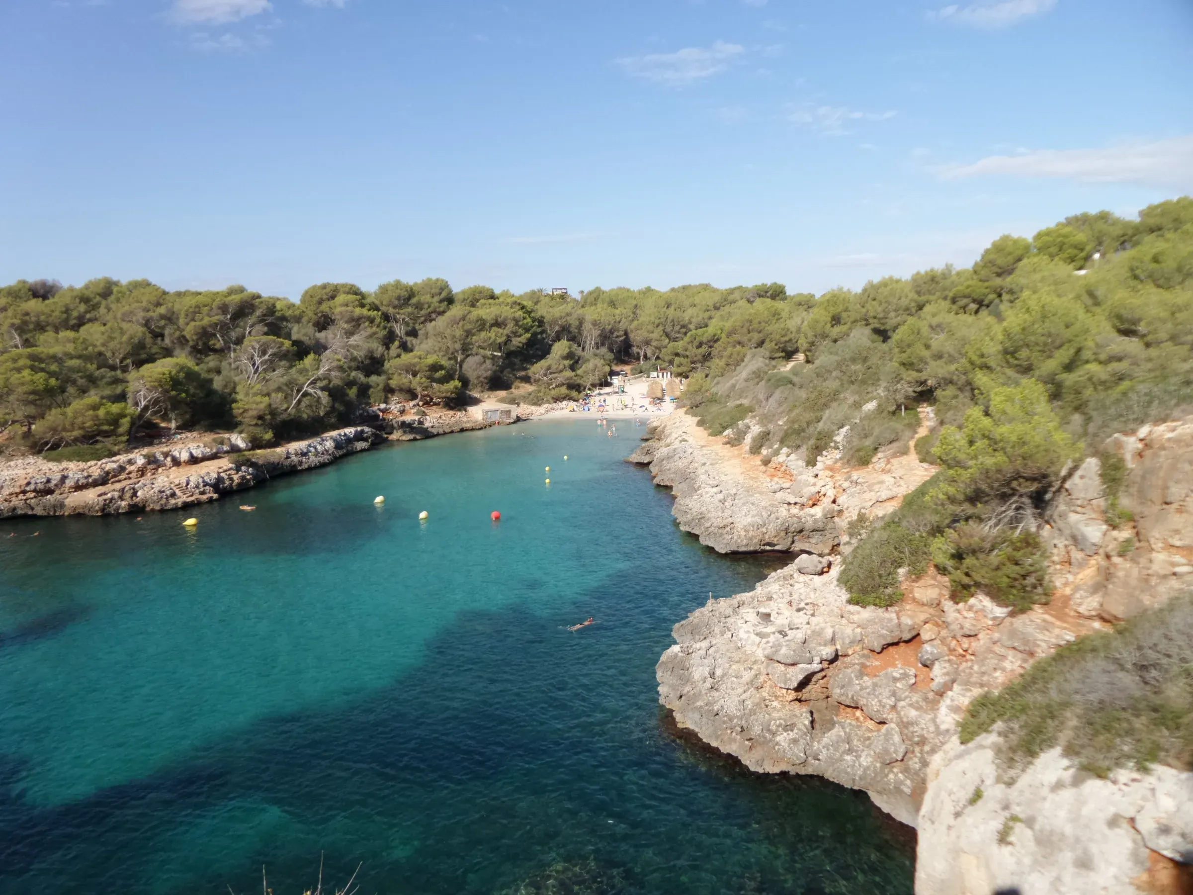
Cala Sa Nau is a fine-sand beach at the end of an inlet about 350 metres long, on the Felanitx coast between Portocolom and Portopetro. There is nothing around it but pine woods and low cliffs. You can get there by car via S’Horta, on foot along the coast from Portocolom, or by boat. From the car park, a stone staircase leads down to the sand. In 2026 it holds a Blue Flag.
Where it is
Like Portocolom, the cove is in the municipality of Felanitx. It lies south of the village, beyond Cala Marçal, Cala Brafi and Cala Estreta. Nau is Catalan for “ship”.
Getting there
By car
The route goes through S’Horta. From there, heading towards Cala Ferrera, a signposted turning leads to Cala Sa Nau. The last stretch is a narrow road of about 2.5 km (Swim Guide). From Felanitx it is about 18 km (Illes Balears).
On foot from Portocolom
From the harbour quay it is about 4.8 km along the coast, passing Cala Marçal, Cala Brafi and Cala Estreta. At a steady pace and without stops it takes a little over an hour. The route is described in our walk from Portocolom to Cala Sa Nau.
By boat
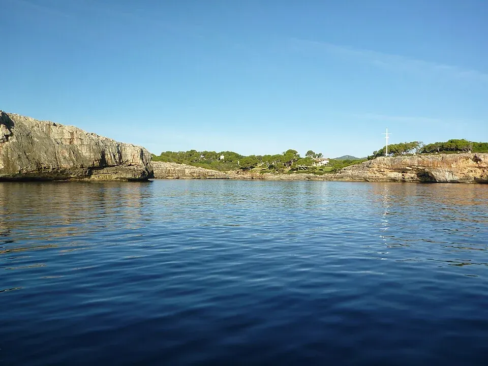
You can also reach the cove by sea from Portocolom or Cala d’Or. The seabed is a mix of sand, rock and Posidonia seagrass meadows (Illes Balears). Anchoring on Posidonia is banned in the Balearic Islands, so drop anchor on sand. More in boat trips and boat hire.
Without a car
No bus route reaches the cove. TIB’s seasonal route 428 stops in S’Horta, but from there it is still several kilometres to the beach. Timetables are in our guide to the bus in Portocolom.
Parking
In June 2025, Felanitx council approved a temporary open-air public car park near the beach access. It holds up to 200 vehicles and may open every year from 15 March to 15 November. The ground is unpaved and stony (mallorca.com), so drive in slowly.
The beach is about 500 metres from the car park, and the last part is a stone staircase (Illes Balears). In high season it often fills up. The map on this page shows where it is.
The cove
The beach is about 60 metres long and 70 metres wide. The sand is fine, and the cove sits between low cliffs covered in pine, juniper and scrub. The pine woods surround the whole inlet and give some shade in summer. The rocky sides are good for snorkelling (see diving and snorkelling).
How much sand there is depends on the winter storms. After Storm Gloria in January 2020, it was estimated that about a quarter of the sand would need replacing (Última Hora).
Like any cove on this coast, conditions depend on the wind and the sea. Check the weather before you go.
Facilities
- Blue Flag in 2026, like Cala Marçal and s’Arenal beach in Portocolom.
- In season, sunbeds and parasols for hire, showers and a beach bar (spain.info, Illes Balears).
- A buoyed area for kayaks and paddleboards. For hire, see kayak and paddleboarding.
Before you go
- Accessibility. Getting down to the sand means using a stone staircase, so the access is not suitable for wheelchairs or pushchairs.
- Summer. The cove is small and the car park has a limited number of spaces. In July and August, the earlier you arrive, the easier it is to find a spot.
- Food and water. Sunbeds, parasols and the beach bar are seasonal. Outside the season, bring what you need.
Nearby coves
To the south are Cala Mitjana, small and surrounded by pines, and Cala Ferrera, a wider beach with more facilities. Towards Portocolom the coast continues past Cala Brafi and Cala Marçal. Each has its own page in the beaches section.
Photo credits
- Header photo: Xxlstier, Wikimedia Commons · CC BY-SA 4.0 · adapted by Portocolom.online
- The mouth of Cala Sa Nau seen from the sea: Wusel007, Wikimedia Commons · CC BY-SA 3.0 · adapted by Portocolom.online
- The inlet at Cala Sa Nau, with the beach at the far end: Xxlstier, Wikimedia Commons · CC BY-SA 4.0 · adapted by Portocolom.online


